Using Portage County, Wisconsin you will see how county changes through the years greatly impact your research. The town used to demonstrate what occurs over time in every family history research is Columbus, Dodge County, Wisconsin today wasn’t always in Dodge County. With Portage County you will also see started in one location and after all changes were made isn’t in the area it was first created; being completely located to another part of the state.
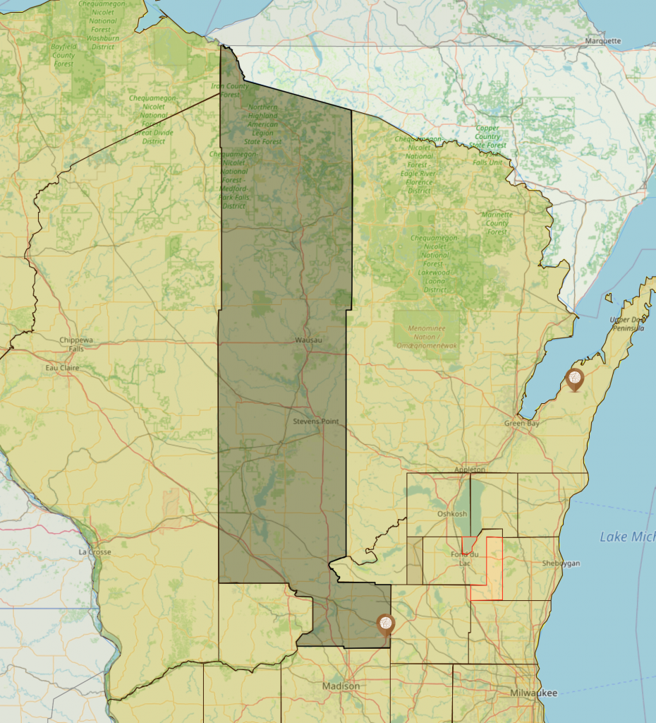
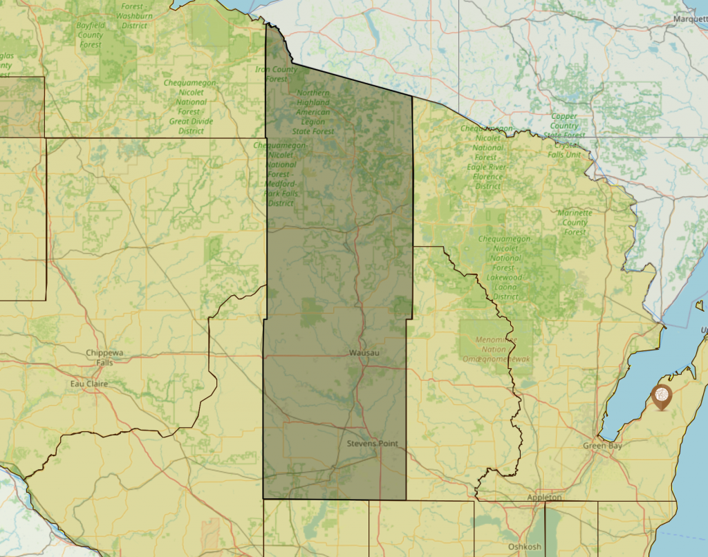
To get started the image below shows Portage County using Google maps. Google maps is a place many family historians use to find ancestors. Even though they are aware of county boundary changes they may not be aware of counties they are researching no longer exist in the area they are starting.
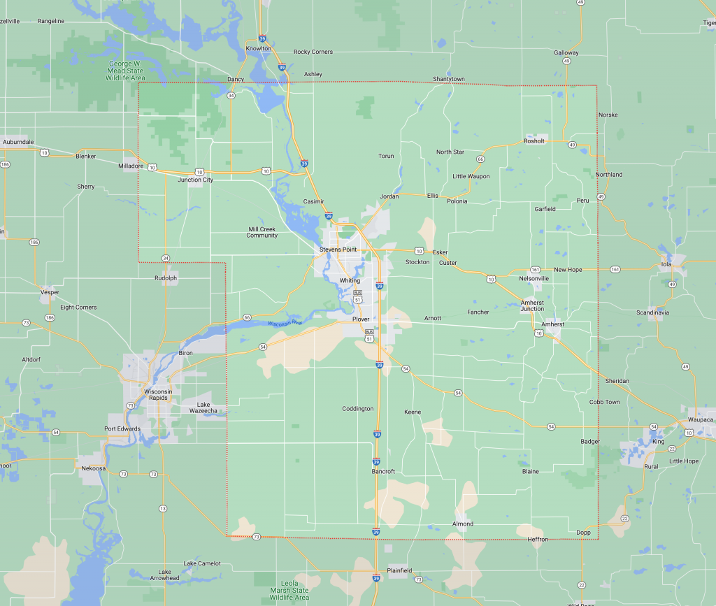
Google maps is clear on boundaries of Portage County today. Portage County was formed on 7 Dec 1836 by the Wisconsin Territory from Brown, Crawford, Iowa and Milwaukee counties and was attached to Brown County for judicial purposes.
If you are familiar with Wisconsin counties you already know from the map the current location is not anywhere near Milwaukee County, therefore already if you are researching between 7 Dec 1836 and 12 Jan 1838, Google maps has you in an area no where close to where you may be starting your research.
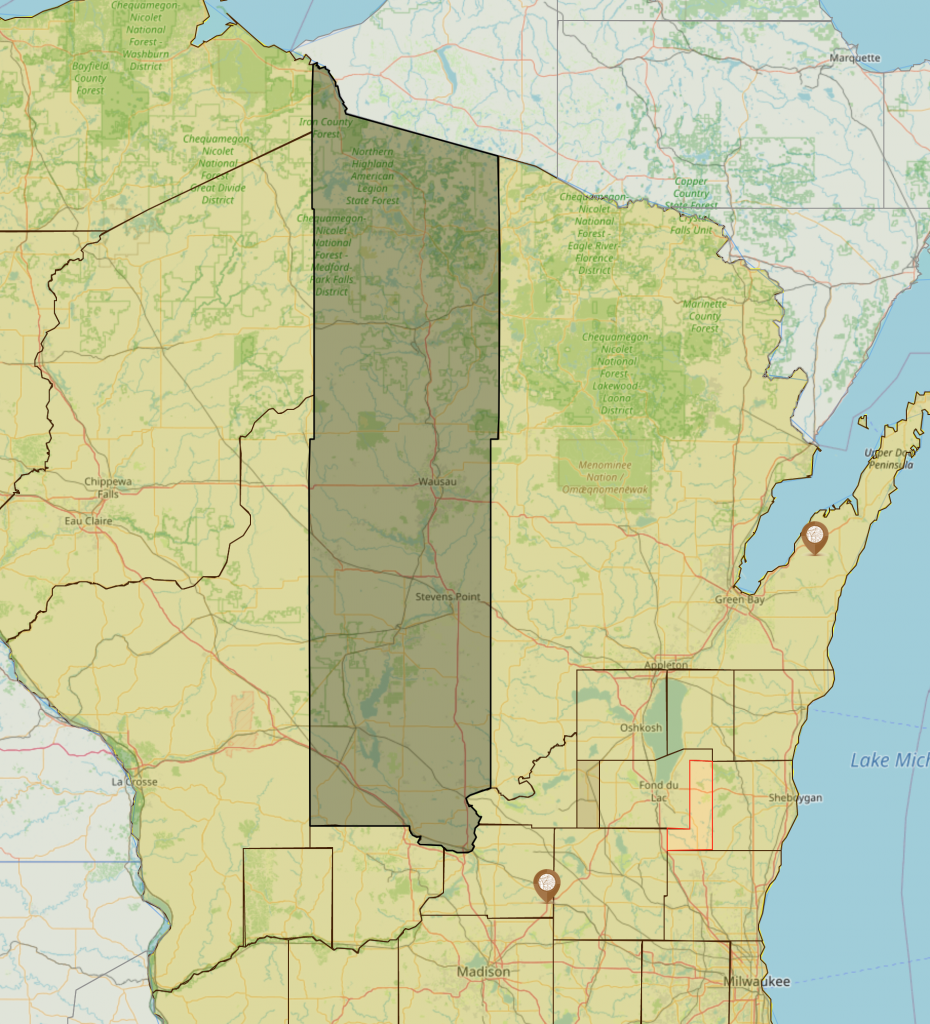
The image above shows Portage County and what it looked like from 7 Dec 1836 until 12 Jan 1838. Dodge county is immediately to the left and AniMap reveals there was an overlap of jurisdiction between Portage and Dodge counties during this time. This overlap targets your research as you now know records in this time frame could be in Brown, Dodge or Portage County. You also have a targeted area where churches are that may hold the records you are looking for.
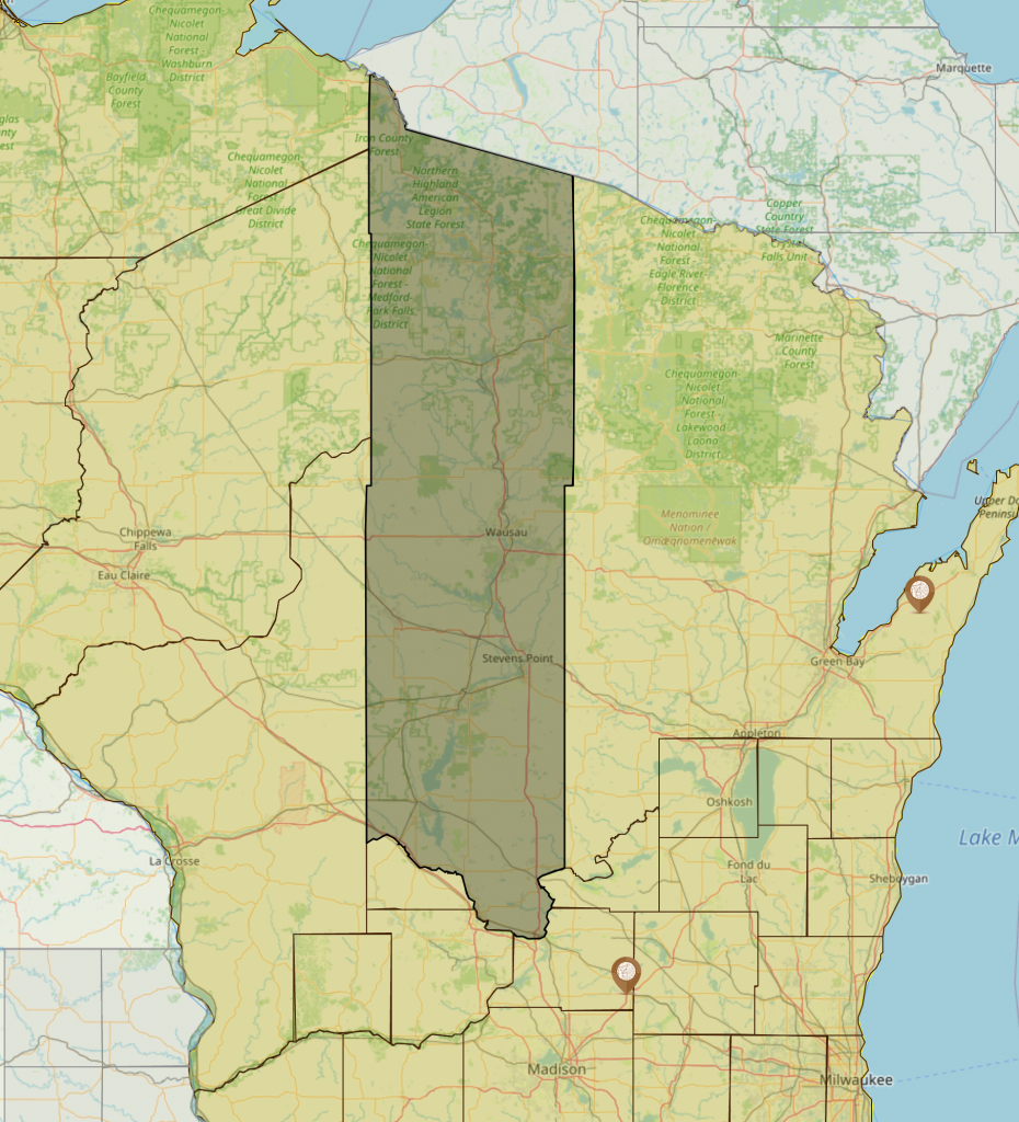
If you are researching Portage County between 12 Jan 1838 and 12 Jan 1840, below is your area of search.
AniMap shows clearly the unique shapes counties took as changes are made. In the image above I am sure not many could ever image today that for two years Portage County looked like this. Your ancestors events between 12 Jan 1838 and 11 Jan 1840 could have occurred anywhere in this area. AniMap further shows if your ancestor is from Baraboo; it is not in Portage County as you may be thinking. Baraboo during this time span is in Crawford County.
Research doesn’t always allow us to know the city, village or even town our ancestors were in, but just a county. Using Google maps even as a starting point can quickly lead you chasing records in locations you can never find them. This leads to hours wasted and great frustration, I myself have been there.
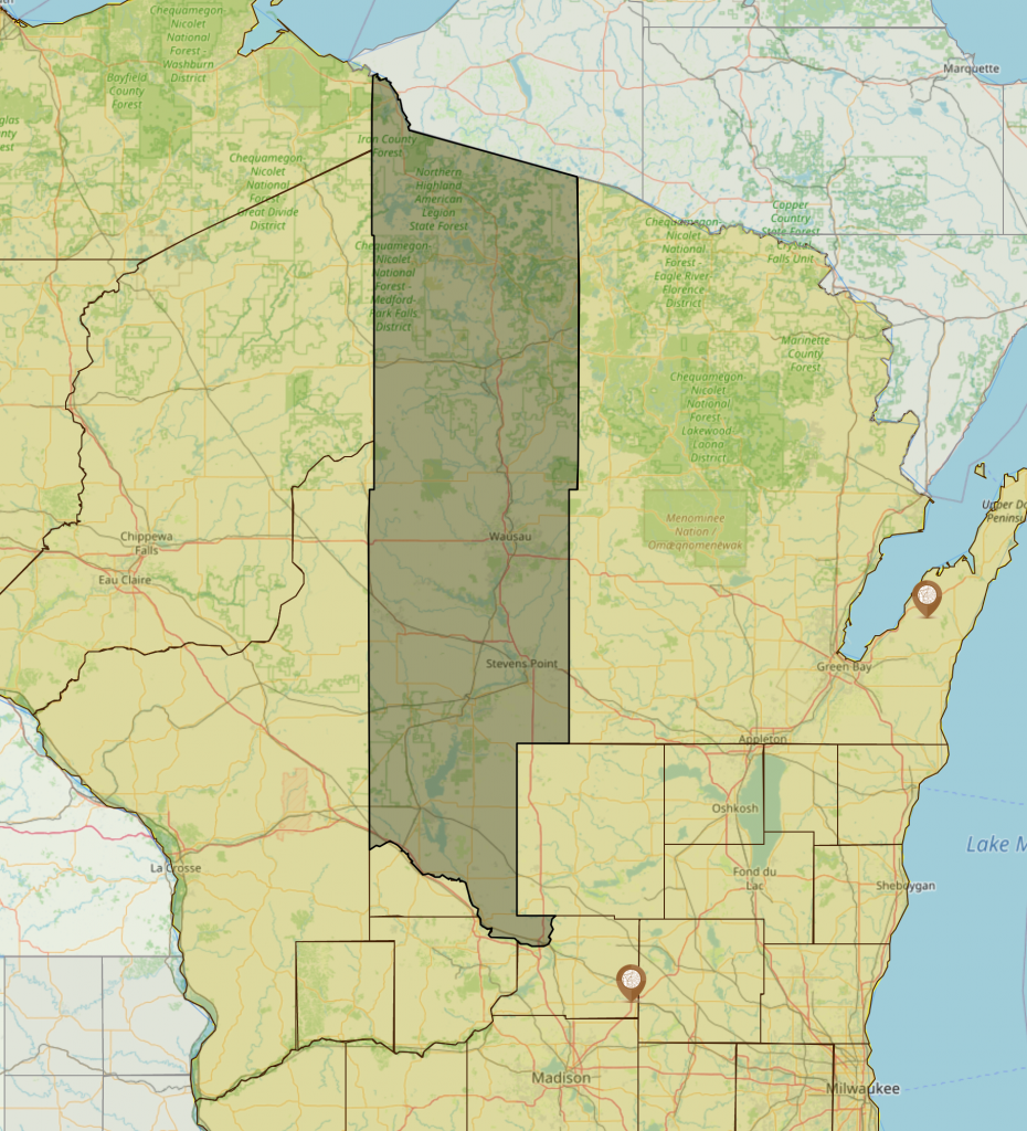
I’m going out on a limb. Surely you knew and could find easily on 11 Jan 1840, Portage County was comprised of two non-contiguous land areas. Wait, really you never thought that happened? Neither did I until I discovered AniMap and created version 4.0. From 11 Jan 1840 until 18 Feb 1841 the image above is what Portage County looked like. Still a long way from the final location Google maps shows you when looking for Portage County. Wait for it; they weren’t done with Portage County yet and had plans that would still create massive change in the boundaries.
Notice the marker for Columbus, Dodge County, Wisconsin; it is still in Portage County during this time frame. Boundaries are changing and fortunately for researchers Columbus is still in Portage.
On 18 Feb 1841 we AniMap shows Portage County has gained a massive amount of land from Brown, Crawford, Marquette, St. Croix and Non-County area 1. At this time included in the change is Portage County is now detached from Brown County and attached to Dane County for judicial purposes. This is a major change in where to research records. As of this change all judicial records will most likely be found in Dane County, prior to in Brown County.
Portage County remains like this having only two additional changes. On 22 Mar 1841, Portage County is now organized for all purposes of county government but remained attached to Dane for judicial purposes.
AniMap contains the law source creating these changes and this change is the first clue we have showing government records before 22 Mar 1841 would be found in Brown, Dane or even Portage counties. Therefore without this information in AniMap you may be stuck in a rut because of looking only in Portage County.
On 23 Sep 1844 by law, Portage County is officially fully organized and detached from Dane County. From this date forward all government records will be in Portage County. At this time the land area is still too big and we would have to research courts during the years we are researching to reveal where the court our ancestor may have used exists.
So far we still don’t have a county seat to know if there was one whereby we can conclude all judicial records at the county level may reside.
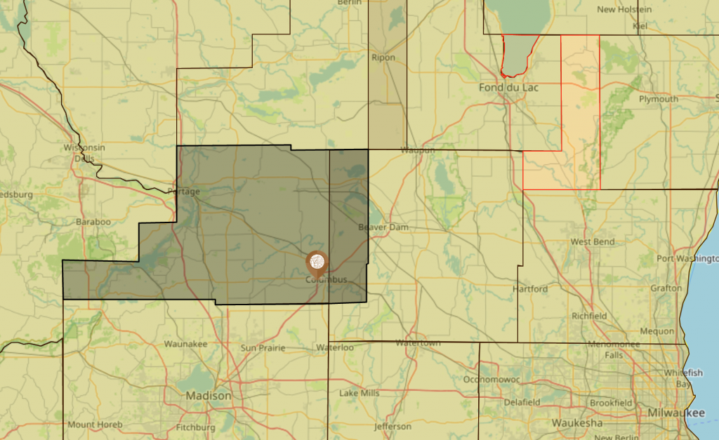
On 1 May 1846 the boundaries of Portage County are changing once again. Columbus, Dodge County, Wisconsin of today now clearly resides in Columbia County. However, Portage County still consists of a massive amount of land and will be subject to change several times.
On 11 Mar 1848 Portage County loses a small area to the creation of Adams County.
29 May 1848 is a non-boundary change. It is on this date Wisconsin becomes a state and this is what Portage County is on that date. Of course on 6 Mar 1849, the state of Wisconsin changed the boundaries of Portage once again.
Between 6 Mar 1849 and 27 Feb 1851, less than two years; Portage County will be subject to four boundary changes leaving a very narrow window of what county you made to research your ancestor in.
Portage County loses area Marquette County.
Portage County now loses to Adams and Columbia counties.
The area lost by Portage County on this date created Marathon County so all area to the north is now Marathon County to over the years be changed to what it became today.
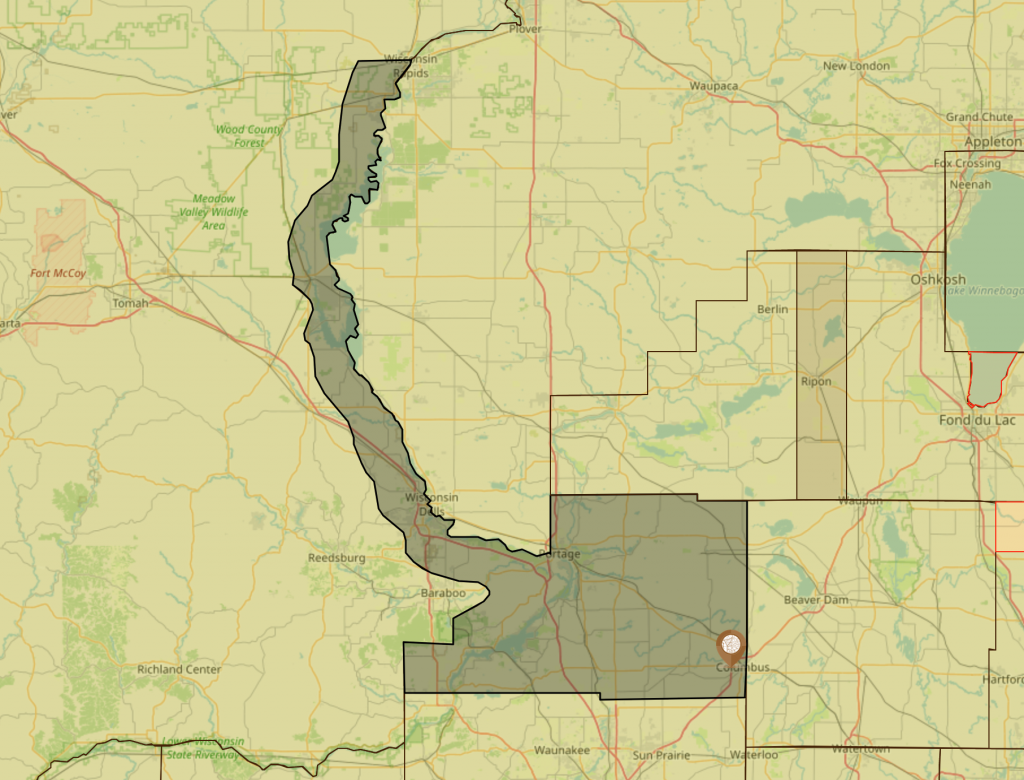
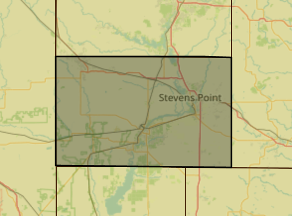
There are still a few more changes two more changes to boundaries and three changes that occurred causing additional confusion to what the decision makers were thinking. It was on 25 Sep 1856, twenty years after Portage County was formed that it becomes the shape and location found in Google maps today. The images show clearly where Portage County was finally defined and has not up to the year 2000 had any additional changes; clearly shows it is not the same location as defined when created.
Portage County, Wisconsin may not be the normal you find when researching records as it did go through many drastic changes over the years. However, there are other counties out there worse than this to research. There are a very small number of counties having one event, the event that created the county and was never changed. There are fewer of those than those having gone through the drastic changes of Portage County.
AniMap won’t have all the answers, however it does have the best solution to target your research with. To understand how county changes impact where you research. With the ability to add information such as locations and notes AniMap can have your answers, and give you a clear understanding what is happening with counties on the dates you are researching.
When I first discovered AniMap 3.02. I knew it was the best research tool I could have hoped for. I find it even more powerful than Ancestry when doing family history. All the information provided by FamilySearch and Ancestry isn’t really of a lot of use to a historian until they can put it into the perspective of the time it happened. Animap brings you this perspective.